Seventy-five years ago this Thursday, Allied forces launched a daring invasion of France’s Normandy region that would bring Nazi Germany a step closer to its final defeat. Here’s how Mike Bechthold, historian and executive director of the Juno Beach Centre, explains the steps that brought the Allies to victory that day.
Approaching Normandy

Library and Archives Canada
Canadian soldiers on board a ship off the coast of Normandy memorize the terrain of their objective by examining air photos of the beach. The troops trained for months knowing only that they would be attacking France. For reasons of security, they were not told the actual location of the attack until they boarded the ships that took them to Normandy.
Juno Beach

Directorate of History and Heritage
The attack on Juno Beach – Mike Red sector (left of the harbour) and Nan Green sector (right of the harbour) – has just begun as Sherman Duplex Drive Tanks arrive on the beach after covering some 1,500 metres from their launch point offshore. On each side of the harbour a single tank from the First Hussars Regiment can be seen to have driven right up to a German bunker. On the right of the photo, another Sherman has maneuvered extensively (see the tracks in the sand) as it engages the German defenders in Courseulles. At least one Sherman can still be seen in the water at the top of the photo.

Library and Archives Canada
A Landing Craft Tank filled with Canadian troops makes its way to Juno Beach on the morning of June 6. In the background can be seen other landing craft and the larger ships which carried the men and equipment across the English Channel from the United Kingdom.
Canada House

Library and Archives Canada
On the afternoon of D-Day, Canadian troops land after the beach has been captured by the Queen’s Own Rifles of Canada. The bicycles were issued to the men of the 9th Canadian Infantry Brigade to help them advance quickly in land. In the centre of the photo is the famous Canada House.

Courtesy of Mike Bechtold
Canada House was one of the first buildings in France to be liberated. It is still there today.
St. Aubin-sur-Mer

U.S. Air Force
The beach at St. Aubin-sur-Mer captured on D-Day by the North Shore (New Brunswick) Regiment. This image was taken on June 22, 1944, and shows a U.S. Army Air Force P-47 Thunderbolt, which made an emergency landing on the beach. In the immediate background is a Sherman Duplex Drive tank of the Fort Garry Horse which was put out of action on D-Day, and further in the distance, a beached landing craft.
Front line, midnight, June 6/7
1
2
3
0
Juno Beach
KM
Saint-Aubin-
sur-Mer
Ver-sur-Mer
Creully
Front line,
midnight,
June 6/7
Front line,
midnight,
June 6/7
Anisy
Front line,
midnight,
June 7/8
Caen-Bayeux
rail line
Rail line
Road
Caen
Town
THE GLOBE AND MAIL, SOURCE: Juno Beach Centre
1
2
3
0
Juno Beach
KM
Saint-Aubin-
sur-Mer
Ver-sur-Mer
Creully
Pierrepont
Front line,
midnight,
June 6/7
Front line,
midnight,
June 6/7
Anisy
Thaon
Bray
Front line,
midnight,
June 7/8
Caen-Bayeux
rail line
Carpiquet
Rail line
Road
Caen
Town
THE GLOBE AND MAIL, SOURCE: Juno Beach Centre
1
2
3
0
Juno Beach
KM
Saint-Aubin-
sur-Mer
Ver-sur-Mer
Creully
Pierrepont
Front line,
midnight,
June 6/7
Front line,
midnight,
June 6/7
Anisy
Thaon
Bray
Front line,
midnight,
June 7/8
Caen-Bayeux
rail line
Carpiquet
Rail line
Road
Caen
Town
THE GLOBE AND MAIL, SOURCE: Juno Beach Centre
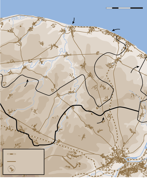
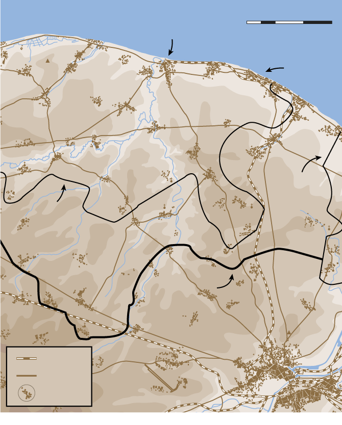
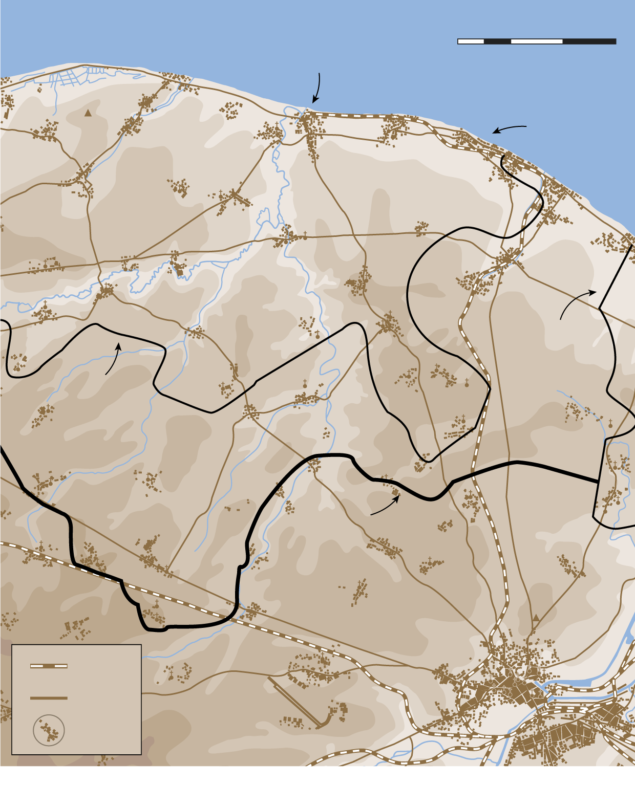
This line marks the limit of the advance by Canadian troops on D-Day. Canadian troops, who advanced farther from the beach than any other Allied forces on June 6, were ordered to dig in where they were in the mid-afternoon due to a counterattack launched by German tanks between Juno and Sword Beaches which made it to within sight of the Channel. The Canadian objective for D-Day was the Caen-Bayeux railway line (at the bottom of the map) which was reached the next day by soldiers of the 7th Canadian Infantry Brigade.