Read more of The Globe’s continuing coverage of the 150th anniversary of Confederation.
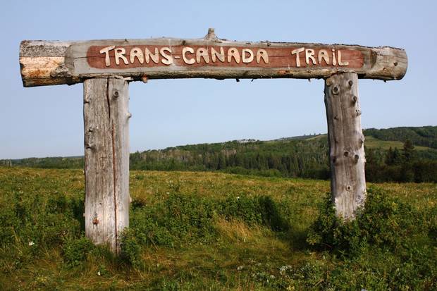
About the trail
The trail will be the longest in the world, measuring 24,000 kilometres, once 432 individual routes are joined in late 2017, according to Trans Canada Trail, a not-for-profit organization.
The Globe reached out to occasional hikers and committed lovers of the trail to submit their photos of their favourite spots in all seasons, from coast to coast. Here are some of the best photos, and a map of where they were taken.
If you are interested in contributing to this growing archive, please e-mail your photos to Transcanadatrail@globeandmail.com. Along with your photo, please include: the place it was taken (as accurately as possible, including GPS co-ordinates if you have them; the date and time of day; who took the photo; and why it's so special to you.)

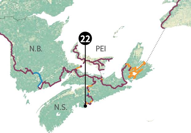
MAPS BY MURAT YÜKSELIR/THE GLOBE AND MAIL
Skip ahead to a region • B.C. and Alberta • Saskatchewan and Manitoba • Ontario and Quebec • Maritimes
B.C. and Alberta
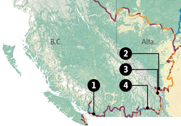
1. Pitt Meadows, B.C.

A bike rests against a tree in Pitt Meadows, B.C., in April, 2015.
COURTESY OF BILL GELLERT
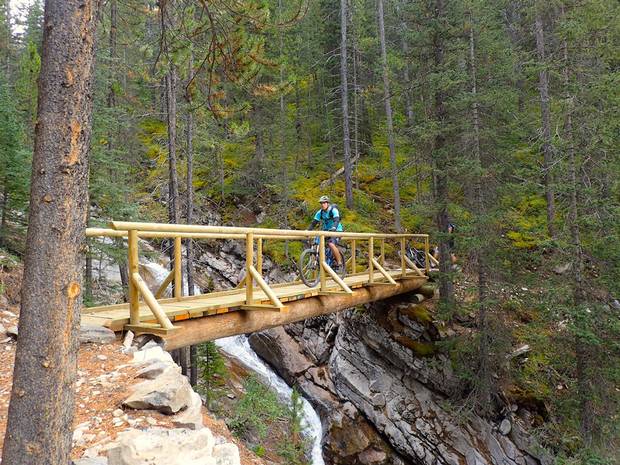
2. Sparrowhawk hike near Canmore, Alta.
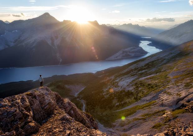
Tyler Lillico took this picture on the Sparrowhawk hike near Canmore, Alta., at sunset on Aug. 13, 2016. The hikers later watched a meteor shower. “It was such a relaxing and peaceful evening to experience a beautiful sunset on a great warm summer day,” he writes.
COURTESY OF TYLER LILLICO
3. Spray Valley Provincial Park, Alta.
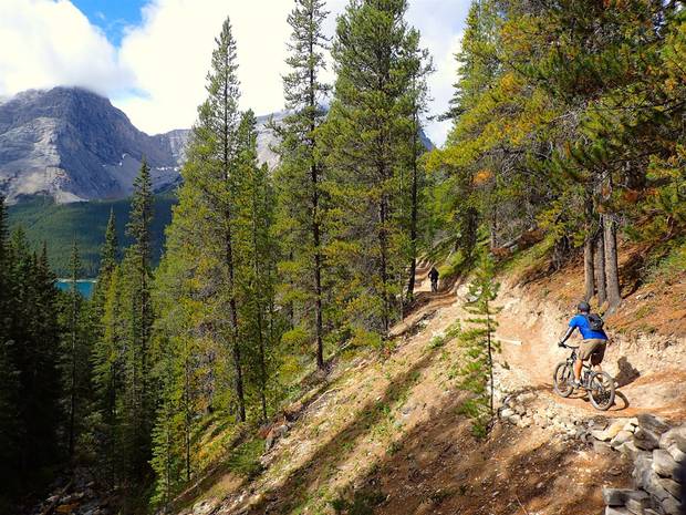
A cyclist treks along the High Rockies Trail in Alberta’s Spray Valley Provincial Park in August, 2016.
COURTESY OF TYLER DIXON
“These photos are special to me because this was the first time we had the opportunity to ride the High Rockies Trail,” Tyler Dixon writes. “We had heard nothing but good things about the trail and I’m happy to say it lived up to the lofty expectations, and more!”
COURESTY OF JEFF NEUFELDT
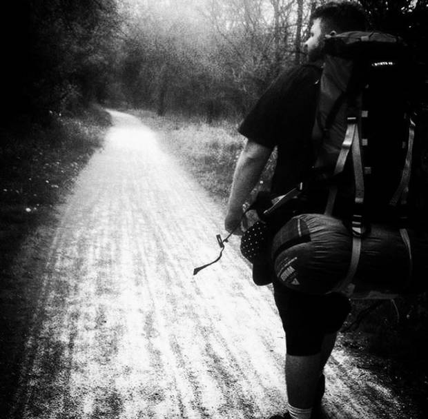
4. Merritt to Fernie, B.C.
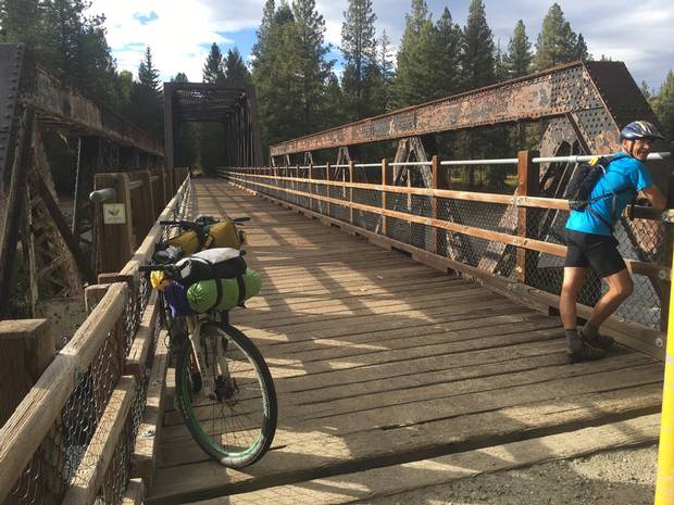
On Sept. 9, 2016, Rob Purdy took this picture of Steve Bloom just outside Rock Creek, B.C., on the Kettle River. The men were tackling the Epic 1000, a 1,000-kilometre route.
COURTESY OF ROB PURDY
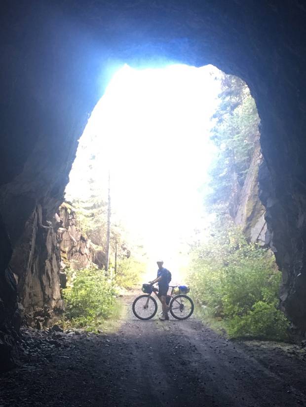
Steve Bloom is shown with his mountain bike, laden with camping gear, on Sept. 10 along the trail between Midway and Grand Forks.
COURTESY OF ROB PURDY
Saskatchewan and Manitoba

5. Cypress Hills Interprovincial Park
A trail sign at Cypress Hills Centre Block in August, 2010.
COURTESY OF TYLER DIXON
A walk along the Spruce Coulee Trail in Cypress Hills Interprovincial Park in July, 2016.
COURTESY OF TYLER DIXON
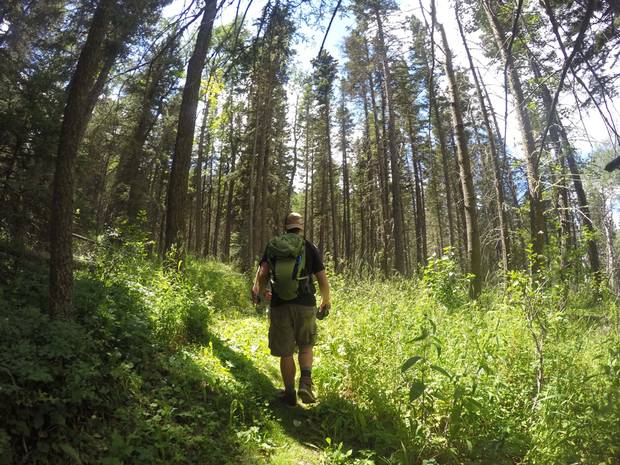
A GoPro camera view shows the trek on the Spruce Coulee Trail.
COURTESY OF MIKE BRYANTON
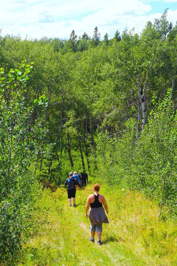
6. The Elbow Trail, Sask.
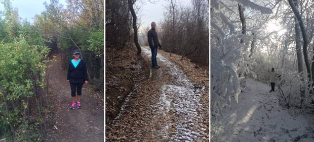
The Elbow Trail through the seasons.
COURTESY OF NATALIE LETTS
7. Qu'Appelle River, Sask.
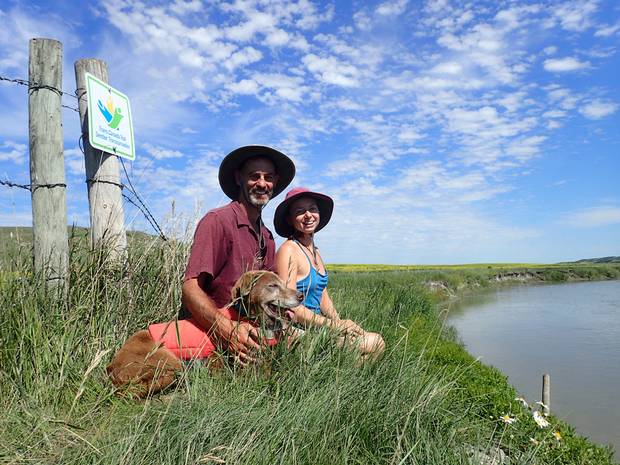
Before her wedding in 2015, economist and PhD candidate Ngaio Hotte went on a 2 1/2-month-long canoe trip across the Prairies with her soon-to-be husband. This picture was taken along the Qu’Appelle River in Saskatchewan. “We had just a few weeks left in our trip and were stopped for a well-earned lunch break,” she writes.
COURTESY OF NGAIO HOTTE
8. Pinawa, Man.

The trail at Pinawa, Man., a small community northeast of Winnipeg.
COURTESY OF H. GRANT DELANEY
Ontario and Quebec

9. Between Fergus and Erin, Ont.
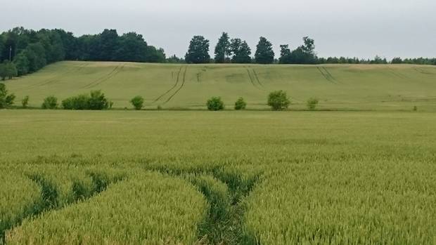
A farmer’s field near Bellwood, on the way from Fergus, Ont., to Erin.
COURTESY OF BRUCE PARKER
10. Caledon Trailway, Ont.
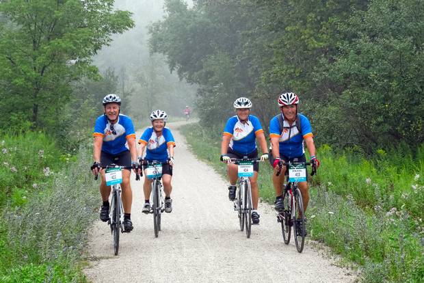
A cycling trip along the Caledon Trailway in August, 2015. “Every day on the Trail is different,” Jim Paré writes.
COURTESY OF JIM PARÉ
11. Brantford, Ont.
Sam Peyton walks and enjoys the trail near Brantford, Ont., in May, 2016.
COURTESY OF SAM PEYTON
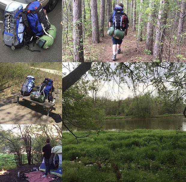
Sam Peyton and his friend Torrin Kooi camp near the river.
COURTESY OF SAM PEYTON
12. Mississauga
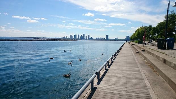
A lakeside shot looking west to Mississauga on Lake Ontario.
COURTESY OF BRUCE PARKER
13. Lang-Hastings Trail, Kawartha Lakes, Ont.

An old railroad swing bridge is shown along the Lang-Hastings Trail in November, 2012. “When I lived in Eastern Ontario we used the Trail extensively – it was an incredible enrichment to the quality of our lives,” photographer Jim Paré writes.
COURTESY OF JIM PARÉ
14. Sir Casimir Gzowski Park, Toronto
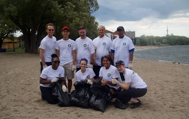
Gamunu Jayasinghe contributed to a project that expanded the trail in the Toronto area, which used to end abruptly at the Scarborough shoreline. He later participated in a cleanup at Sir Casimir Gzowski Park, shown here.
COURTESY OF Gamunu Jayasinghe
15. Cherry Beach, Toronto
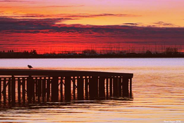
The sun rises over Cherry Beach on April 24, 2016. “I love this part of the trail; it’s my hometown and we only go back twice a year,” writes photographer Mark Hopper of Belleville, Ont.
COURTESY OF MARK HOPPER
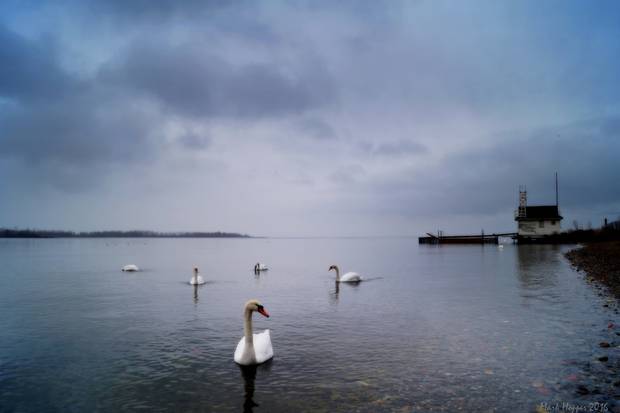
Swans pass along the shore at Cherry Beach – “truly a gift in the heart of Toronto,” Mark Hopper writes.
COURTESY OF MARK HOPPER
16. Waterfront Trail, Toronto
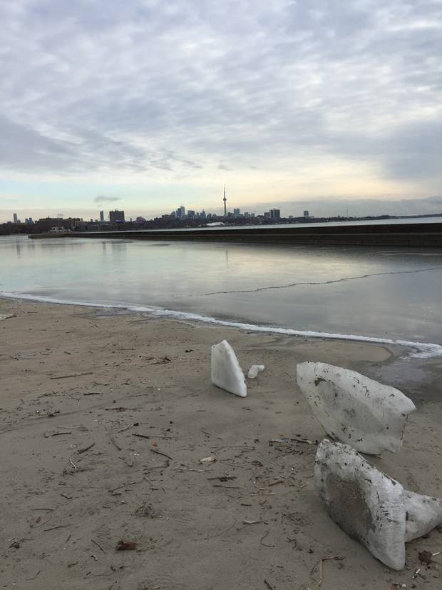
Ice lies on the beach on Toronto’s Waterfront Trail on Jan. 14. “I use the Waterfront Trail regularly,” photographer Jane Craig writes. “This one stretch of trail can be so different depending on the day and season. Today the ice was spectacular.”
COURTESY OF JANE CRAIG
17. Gatineau Park, Que.
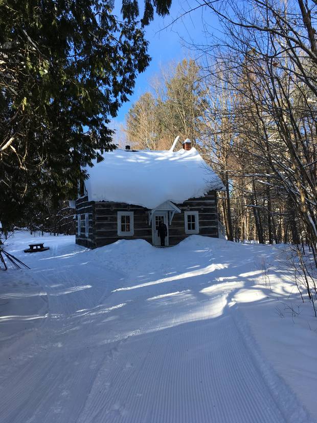
The Herridge cabin, used by cross-country skiers as a warming shelter and rest stop in wintertime, is shown on New Year’s Day, 2017. “This is a peaceful place deep in the woods and home in winter to woodpeckers, blue jays, chickadees, red squirrels and the occasional deer,” writes David Holmes, who took the picture. “One of my favourite places.”
COURTESY OF DAVID HOLMES
18. Brown Lake Cabin from Wakefield, Que.

The day before his wedding – Aug. 10, 2001 – Ken Neufeld took this picture of his wife’s brother and her family at the trail entrance to Brown Lake Cabin from Wakefield, Que. “They are from Arizona and they were scared of the cold,” Mr. Neufeld writes. “It was 36 degrees … for our wedding, which took place under the Wakefield covered bridge. We kind of blew apart their preconceptions of Canada on this day.”
COURTESY OF KEN NEUFELD
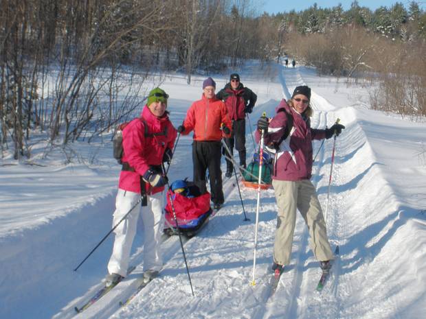
This photo shows Trail 52 in Gatineau Park, near Brown Lake Cabin, in February, 2002. “We always rent the cabin for a night and get a gang of 18 people to come out for great food, skiing and fun times around the wood stove,” he writes.
COURTESY OF KEN NEUFELD
19. Walker Woods, New Hamburg, Ont.
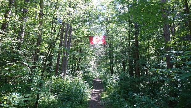
A Canadian flag flies near Coppin’s Corners in Walker Woods.
COURTESY OF BRUCE PARKER
20. Stittsville, Ont.

Boo the schnoodle goes for a walk along the trail off Abbott Road in Stittsville, a western suburb of Ottawa.
COURTESY OF PATRICK WIECZOREK
21. Downtown Ottawa

The Parliament buildings in Ottawa. The Great Trail loops around Parliament Hill and along the Ottawa River.
COURTESY OF BRUCE PARKER
Maritimes
22. Lawrencetown Beach
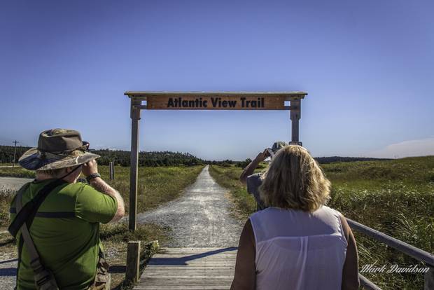
A group gets ready for a 10-kilometre hike of the Atlantic View Trail at Lawrencetown Beach on Sept. 4, 2016. “This trail spoke to us on this warm September day as it offered rural seaside vistas, stretching beside small communities, and along coastal inlets … all the while surrounded by the smell of the fresh salt air coming ashore from the Atlantic Ocean,” photographer Mark Davidson writes.
COURTESY OF MARK DAVIDSON
CANADA 150: MORE FROM THE GLOBE AND MAIL