British Columbia: In the snow
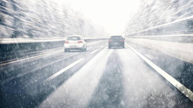
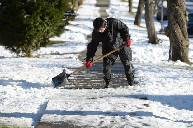
Vancouver gave away bucketloads of free road salt on Wednesday as an unusually cold and snowy winter torments the traditionally temperate West Coast, turning some streets and sidewalks into impromptu skating rinks.
Jerry Dobrovolny, Vancouver's general manager for engineering services, said 10 fire halls would have de-icing salt available starting for locals who can't find any at local stores. As the day went on, supplies ran low and city officials had to keep a tight limit on how much salt residents could take.
Huge response to limited supply of salt at 10 firehalls = very low supply. Salt/sand coming in afternoon: pls take 1 bucket max only! pic.twitter.com/hxQhFAt1pG
— City of Vancouver (@CityofVancouver) January 4, 2017
This is chaos! #SaltLine outside hall 14 hundreds of people long. Still waiting for salt to arrive. Any ETA, @CityofVancouver? @GlobalBC pic.twitter.com/SW4zDnW25S
— Jordan Armstrong (@jarmstrongbc) January 4, 2017
So far this winter, the city – which was hit with its first significant snowfall in more than two years – has gone through about 7,000 tonnes of salt, which is seven times the average amount used in each of the previous two winters. Environment Canada forecasted that the low temperatures would not lift until mid-January. Here's Frances Bula's report for The Globe on how the city is redeploying its staff to deal with the winter conditions.

Tyler Mitchell stops for vehicles while playing hockey on the icy street near East 43rd Avenue and St. George Street in Vancouver on Jan. 3, 2017. City of Vancouver crews have fallen behind in maintaining the side streets, turning them into skating rinks.
RAFAL GERSZAK FOR THE GLOBE AND MAIL
The Prairies: In the cold
Manitobans were bracing for a cold day Wednesday, a day after a snowstorm temporarily shut the main highway between Winnipeg and the U.S. border.
Environment Canada warned of extreme wind chill – sometimes below -40 – in parts of southern Manitoba on Wednesday morning.
Highway 75 and several others were shut down earlier Tuesday due to the latest snowstorm in the area. Strong northerly winds were reducing visibility to 500 metres in open areas.
Meanwhile, an extreme cold warning for parts of Saskatchewan and Alberta was lifted Tuesday.
Eastern Canada: In the rain
Large swaths of New Brunswick were under weather alerts Wednesday for freezing rain and snow as a low-pressure system near Cape Cod moved across the province.
The pressure system was also set to batter Prince Edward Island and parts of Nova Scotia with heavy winds, with about 20 mm of rain and patches of fog expected in the Halifax area.
You're gonna wanna break out yer paddle & give yourself extra time to get to work today! Highwinds & lots of rain make for hazardous driving
— Halifax_Police (@HfxRegPolice) January 4, 2017
If you see flooding on streets in your area, please report to 311 & crews will be dispatched. Thx for your cooperation. #nsstorm
— hfxgov (@hfxgov) January 4, 2017
Quebec: In the dark
More than 57,000 Hydro-Québec customers were without electricity by midday Wednesday due to freezing rain. Hydro-Québec says most outages are due to ice-covered branches snapping and falling onto power lines.
Plus de 150 équipes sont au travail. Consultez la carte Info-pannes pour suivre la situation dans votre secteur. https://t.co/ujBephKiSZ
— Hydro-Québec (@client_hydro) January 4, 2017
The regions most affected are the Laurentians north of Montreal, communities south of the city and in western Quebec. The freezing rain was expected to gradually change to snow overnight, with two to four centimetres expected. However, some areas of eastern Quebec could get up to 25 centimetres of snow, accompanied by strong winds.
Hydro One was also reporting several hundred homes and businesses without electricity early Wednesday in communities scattered across Eastern Ontario. Some power outages were reported in Ottawa.
Toronto: In the clear (for now)
Eastern Ontario's icy weather didn't extend as far as Toronto, which has had mild and cloudy weather for the past few days. But temperatures are expected to drop sharply heading into the weekend.
With a report from Globe staff
MORE FROM THE GLOBE AND MAIL